
SALLA - HAUTAJÄRVI - RUKA
This guided hike takes to the most beautiful places in Salla National Park as well as on the most famous hiking route – Karhunkierros – in Finland.
DETAILS
This is our longest hike – 7 days (6 nights) so you will be enjoying full week of enchanting nature wonders. Whole route is about 127 kilometer long.
We start this hike from Salla Ski resort and hike through the Salla National Park to UKK route. We will follow UKK route to Hautajärvi where we switch to Karhunkierros hiking trail.
We will organize also accommodation close to the Salle Ski Resort, please contact us if you are interested. Also shared rides from Ruka to Salla is available before or after the hike.
PRELIMINARY SCHEDULE
We will meet at Salla Ski Resort at 9 AM. After checking and adjusting the gears we will start our day 1 hike, which is about 15 kilometers.
Our hike goes via Salla visitor center to Ruuhitunturi fell. If the weather is good, we will visit on top of the hill to admire enchanting views around the Salla National Park. Our lunch break will be in the surroundings of Ruuhitunturi.
From Ruuhitunturi we will continue our hike via Kuusikko-Ruuhivaara hills to Aikkipetsi day hut. We will stay first night nearby to the hut.
After the breakfast we will pack our backpacks and head to the day hike. On the second day we will hike around 19 kilometers.
First half of the day we hike along the old bog meadows and large bogs until we will arrive to Ylimmäinen Palotunturi fell. We will hike on the top of the fell and then proceed to the Konttilampi pond goahti.
From the goathi we will continue our hike besids Palotunturi towards to Puupalovaara hill, where we will head to our camping place, Tervalammit pond. Nearby Tervalammit goahti we will place our tents and stay over night.
Day 3 is the longest stage measured on kilometers. We will hike around 24 kilometers until to Vasaoja lean-to which our destination. Although there is a long hike, our trail is mostly easy-to-hike without any big differences on heights.
Our first destination is Karhunkierros visitor center in Hautajärvi where we will have our lunch break.
After the lunch, on our way, we will cross the Kouta River several times, e.g. along the suspension bridge. We hike along the banks of the Savinajoki and see Rupakivi, which is Finland’s largest river gorge.
We also step off the route to see nearby attractions
We set up our camp near the Vasajoki lean-to and fire place..
After breakfast, we set off to Merenoja, which is our camping place for next night. Day 4 we will hike around 19 kilometers.
In the morning, we cross the Oulanka River with the suspension bridge, proceed through the ridge landscape, cross small streams and arrive at Taivalköngäs rapids, from where there is an enchanting view of the Oulanka River. We also cross the river along suspension bridges and continue to Runsulampi for a lunch break.
After the lunch break, we hike through the Oulanka camping area to the Oulanka nature center. After this, we will arrive at Kiutaköngäs, which is a breathtaking experience formed by rapids and waterfalls about 200 meters long.
The memories of the enchanting Kiutakönkäs cover the last kilometers of the day to the Merenoja, where we set our tents.
Day 5 we will hike about 17 kilometers and the destination is Ylikota lean-to and fire place.
In the morning, we pack our backpacks and start hiking along the Oulanka River on the shoreline. We get to admire the stunning views of the slowly flowing Oulanka River and the river bank.
We pass Kulmakkopuro and hike along Kulmakkovaara hill to the Jussinkämppä, where we have a lunch break.
We will continue in the varying scenery to the Ylikota lean-to and fireplace. where we set our camp. The place is located on the shore of the Kitkajoki River right next to Pähkänänkallio. In the evening, we can admire the rugged Pähkänkäkallio and with the last hikes of the autumn summer we can take an evening trip to Pähkänänkallio after the end of the restriction period (on hikes after 15.8).
Day 6 we will hike about 18 kilometers. Our destination is the beautiful Porontimajoki hut and its surroundings.
First, we will hike along the Kitkajoki river, after which we walk a little further from the river. We arrive at Harrisuvanto and cross the river along the suspension bridge. We hike along the Kitkajoki and the Kitkajoki is visible almost all the time until we arrive at the lunch spot in Siilastupa near the Jyrävä falls.
After lunch, we will continue on an easy route alongside of the Jyrävä and Aallokkoski rapids. After that we will leave Oulanka National Park behind and we continue to Porontimajoki hut, where we camp and prepare for the last day, which is definitely the most demanding of the hiking day.
The last day of the hike is definitely the hardest due to the many climbs. Of course, every climb will reward you with amazing and enchanting views of the rugged nature of Kuusamo. The length of the day is approx. 16 kilometers and we end the hike in Ruka.
We start the day in easy-to-pass terrain. We rest at Iso-Kuikkalammi lean-to before going up to Iso-Kumpuvaara and Konttainen hills.
At Konttainen we take a break again, admiring the rugged scenery on the rock cliff before we continue down to the Konttainen parking lot and start the heavy climb towards Valtavaara.
At Suolampi lean-to and fireplace, we will have a lunch break and catch our breath before the last climb to Valtavaara. At the day hut at the top of Valtavaara, we admire the scenery and descend towards Ruka, ending the hike there.
At the end of the hike, we hold a debriefing session about the experiences of the hike before we end the hike.
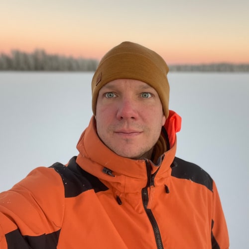
YOUR GUIDE
Your guide on these hikes is Tommi Kallberg - Oulangan Taika Oy:n founder and experienced in hiking on artic area as well as on this route.
CONTACT US!
Do you have any questions? If yes, please fill in the form and we will get back to you as soon as possible. You can also send us an email to info@oulangantaika.fi or WhatsApp us in +358405900001.

